Wim van Velzen photography - landscape
NEDERLANDS |
home |
new |
landscape |
articles |
sitemap |
about |
contact
Isle of Arran
© Wim van Velzen
15 photographs - click on the images to enlarge
back to portfolios
 |
 |
 |
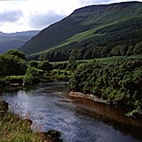
| Glen Rosa 1 large |
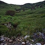
Glen Rosa 2 |
Glen Rosa 3 |
 |
 |
 |
| Glen Rosa 4 |
Glen Rosa 5 |
Glen Rosa 6 |
 |
 |
 |
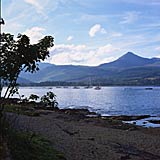
| Brodick 1 |
Brodick 2 |
Imachar |
 |
 |
 |
 |
| Kildonan |
Blackwaterfoot 1 |
Blackwaterfoot 2 |
Blackwaterfoot 3 |
 |
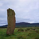 |
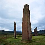
| Machrie Moor 1 |
Machrie Moor 2 |
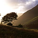
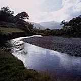
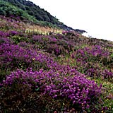
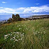
The Isle of Arran, situated between the long southwestern peninsula of Knapdale and the Lowlands, is often called Scotland in miniature. The northern part is rough and bleak like the Highlands, the south is has the rural character of the Lowlands.
The isle is about 20 x 30 km and the roads are easily
described as the number 8: a ring road
and a road right through the middle of the island. The roads are especially fit for cycling - and the number of bikes is higher than elsewhere in Scotland indeed.
Around the highest mountain, Goat Fell (874 m), there are lot of climbers, but for the less ambitious outdoor
sportsman even a simple walk is a fantastic experience. There are some nice car-less glens to explore and enjoy.
Because the island is easily reached from the larger cities, the Isle of Arran is popular with tourists, especially the kind that enjoys nature as long as a drink is near hand. Or a golf course.
Nevertheless it is quite easy to escape the busy parts, although one will never feel lonely.
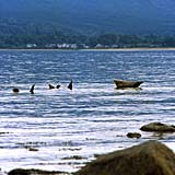
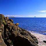
A must see are the seal colonies in Brodick Bay (at Merkland Point, just north of Brodick) and near Kildonan on the south coast. They are quite used to homo sapiens, without begging for cookies.
Something totally different, but not less impressive, are the monolithic monuments near Machrie. It is always a fascinating thought that thousands of years ago these stones were already erected thousands of years ago.
return to top